Bomb Cyclone
AccuWeather® Global Weather Center
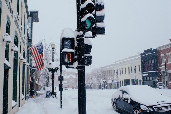
A rapidly strengthening storm is expected to explode into a powerful bomb cyclone along the Atlantic coast this weekend, delivering heavy snow to parts of the Southeast, dangerous coastal flooding along the East coast, along with the potential for snow in parts of the Northeast and New England.
“This storm could unleash heavy snow and howling winds across the Southeast this weekend. People need to prepare for the possibility of dangerous blizzard conditions in some coastal areas from North Carolina to the southern Jersey shore. Blizzard conditions may reach parts of Long Island and southern New England,” AccuWeather Senior Meteorologist Scott Homan said.
Major business, supply chain, delivery and travel disruptions are expected along the path of the storm.
AccuWeather experts say more than 5,000 flights could be cancelled across the country Saturday through Monday.
Southeast and mid-Atlantic Winter Storm Impacts
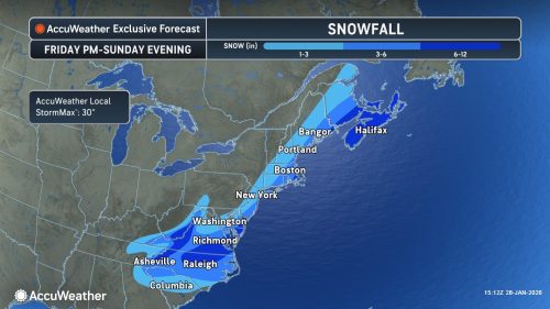
AccuWeather expert meteorologists say significant snow is increasingly likely across North Carolina and southern Virginia, where several inches could fall. Blizzard conditions may develop in the hardest-hit areas.
“Blizzard conditions are dangerous because heavy snow and powerful winds can rapidly reduce visibility in seconds. People trying to drive through the storm may not be able to see hazards like downed power lines, fallen trees or disabled vehicles until it is too late. What starts as manageable snowfall can turn into life-threatening travel conditions in minutes, especially on highways and open roads where wind gusts are strongest,» Homan warned.
Biggest snowfall in decades possible for metros in the Southeast
For cities such as Charlotte and Raleigh, this storm has the potential to become one of the most disruptive snow events in years, if not decades.
For historical context, Charlotte’s last comparable snowstorm dropped 8.3 inches of snow in January 2003, while Raleigh’s all-time record stands at 20.3 inches from January 2000.
“This is not just another storm. It is another setback to a region that has already been under stress from ice, snow and prolonged freezing temperatures,” Homan said. “When you stack winter hazards back-to-back like this, the impacts compound quickly, especially in the Southeast where winter weather resources and equipment are limited.”
Storm impacts expected to expand up the East Coast
As the storm intensifies Friday night into Saturday, strong winds and rising seas will push water onshore from North Carolina to New England, producing coastal flooding and beach erosion.
“Beach erosion is one of the hidden hazards of powerful winter coastal storms. When waves repeatedly crash against the shore on top of elevated water levels, dunes can be carved away and protective berms can vanish, leaving communities more exposed to future storms,» Homan said. “With a full moon this weekend, astronomical tides will be higher than normal. That means even a modest storm surge can push water much farther inland than people expect. Coastal residents need to be prepared for flooding near high tide.”
With the added influence of the full moon and higher astronomical tides, some coastal communities could see water levels surge 2 to 4 feet above normal around high tide, including Norfolk, the Outer Banks, coastal New Jersey and parts of Massachusetts.
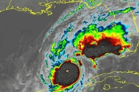
The storm is forecast to rapidly intensify into a bomb cyclone along the southern Atlantic coast on Saturday, with atmospheric pressure plunging at least 24 millibars in 24 hours or less.
“This winter storm will be much smaller and impact fewer cities and people compared to last weekend’s storm, but it will pack a punch with dangerous impacts along the coast,” Homan said. “Travel will be treacherous, if not shut down in some areas. Preparation and caution are critical through the weekend.”
Northeast and New England Winter Storm Impacts
AccuWeather expert meteorologists say the storm track will determine whether cities along the Interstate 95 corridor in the Northeast get heavy snow, light snow or almost nothing at all. Small shifts offshore will control how far inland accumulating snow reaches from the mid-Atlantic into New England from Saturday into Sunday.
Southeastern Massachusetts has the highest likelihood of 6 to 12 inches of snow, with 3 to 6 inches possible across southeastern New England, Long Island and coastal New Jersey and Delaware.
Blizzard conditions are possible at times late Saturday through Sunday across parts of coastal New England and Long Island.
Along Interstate 95 from northern Virginia to New York City, dry air may sharply limit snowfall. In some locations, a shift of a dozen miles could mean the difference between slick, snow-covered roads and little more than a few flurries.
Boston and Providence have a much better chance of seeing half a foot of snow than New York City or Philadelphia.
Dangerous cold surges across the eastern US
Frigid nights will deepen the hardship across the Southeast in the wake of recent ice and snowstorms, especially in areas still dealing with widespread power outages.
Temperatures 15 to 30 degrees below the historical average are forecast to grip much of the central, southern and eastern U.S. through the weekend into next week.
More than 370,000 customers have been without power for days after the recent weekend winter storm across parts of Tennessee, Mississippi, Louisiana, Texas, Kentucky, Florida, New Hampshire and South Carolina as of 3 p.m. E.T. on Jan. 28.
Even where daytime sunshine allows limited melting in areas impacted by the recent weekend ice storm, refreezing after sunset can quickly turn wet roads and sidewalks icy.
Frigid conditions will persist across the Northeast through the weekend.
«We are currently forecasting at least a 12-day stretch of temperatures staying at or below freezing in New York City» AccuWeather Senior Director of Forecasting Operations Dan DePodwin said. «That stretch would rank among the top 10 longest subfreezing stretches on record, and it is not out of the question it climbs into the top five. The longest stretch in city history is 16 days.”
Arctic air will press southward for several more nights, bringing widespread freezing temperatures deep into the Southeast and pushing frosts and freezes into north-central and interior Florida, increasing the risk of impacts to unprotected pipes along with citrus and other crops.
“Freezing temperatures and timing are critical for Florida’s citrus industry. Even brief freezes can damage fruit, but multiple cold nights in a row increase the risk of lasting harm to trees and yields, particularly across interior growing regions,” Homan said. “Growers are watching temperatures closely because once citrus is damaged by cold, the effects are not always immediately visible. The true impact often becomes clearer days or weeks later, which adds another layer of uncertainty.”

The Views Expressed In This Article Belong Solely To The Original Author, And We Assume No Responsibility For Its Accuracy, Completeness, Or Any Consequences Arising From Its Use.
[penci_index title=»You Might Find This Interesting—So Might Someone You Know» cat=»» numbers_posts=»3″ columns=»3″ display_title=»yes» display_cat=»no» display_date=»yes» display_image=»yes» image_size=»square» cat_link=»yes» cat_link_text=»View All» /]